Integration
- Our solutions are based on commercial cloud-based or desktop GIS applications including ArcGIS Pro (ESRI) and Google Maps and leverage supported APIs for visualization, geometry, and spatial analysis services
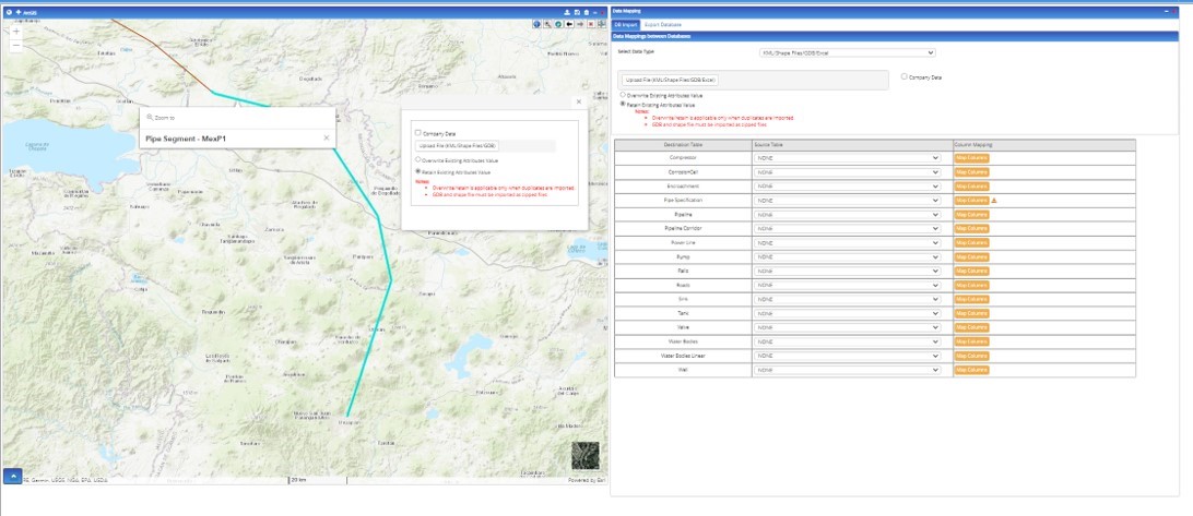
- We support the import of data from commonly-used oilfield and pipeline industry geodatabase formats such as PODS and UPDM as well as with data stored in KML/KMZ formats and flat files (MS Excel)
- Our proprietary EICEbox tools (hydraulic analysis of wells/pipes, gathering/distribution network) are integrated with our GIS solution to enable visualization of engineering analysis results in spatial context
Example Geodatabase file import
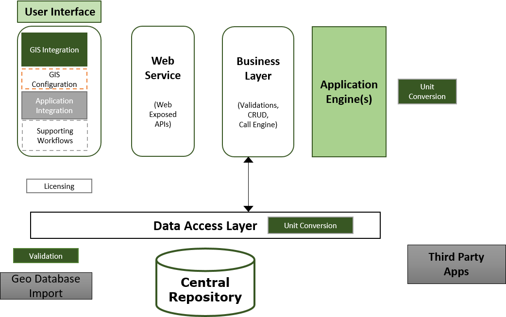
Web Application Development
-
Our software development team specializes in developing customized GIS-driven applications combining geospatial data with engineering and business intelligence solutions. Our experience includes the creation of a GIS hub for applications integration for a leading software vendor of pipeline analysis software
Example Engineering Application platform with GIS
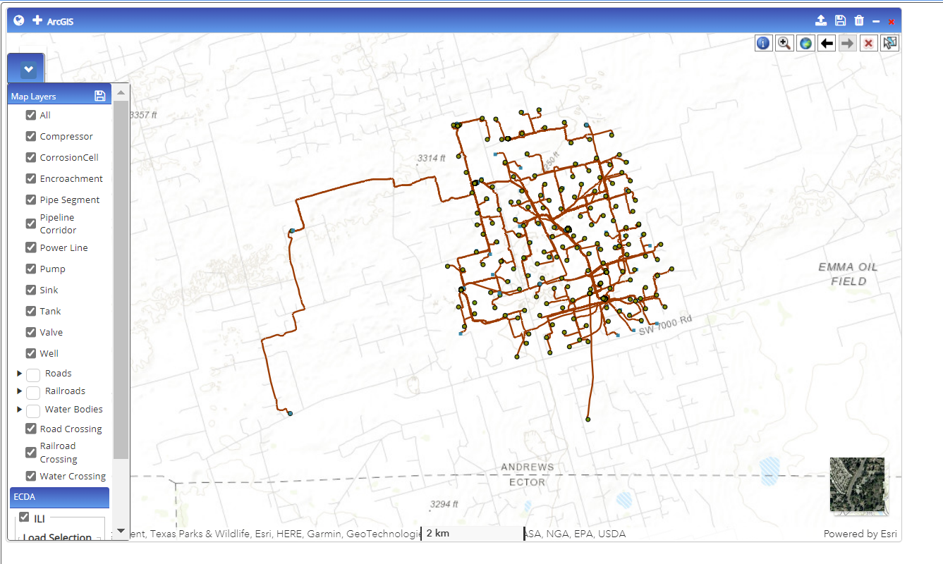
Business Intelligence
The following are example business intelligence applications created using GIS:
- Pinpoint the location of pipeline crossings with roads, railroad lines and waterways
- Run corrosion analysis calculations and display the failure regions on the map
- Identify thresholds (high pressure areas) on map with layers
- Identify highest and lowest elevation points for hydrotest regions
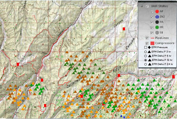
- Display pipeline gathering/distribution networks with field measurements to track potential operational issues
Example railroad intersection with pipeline
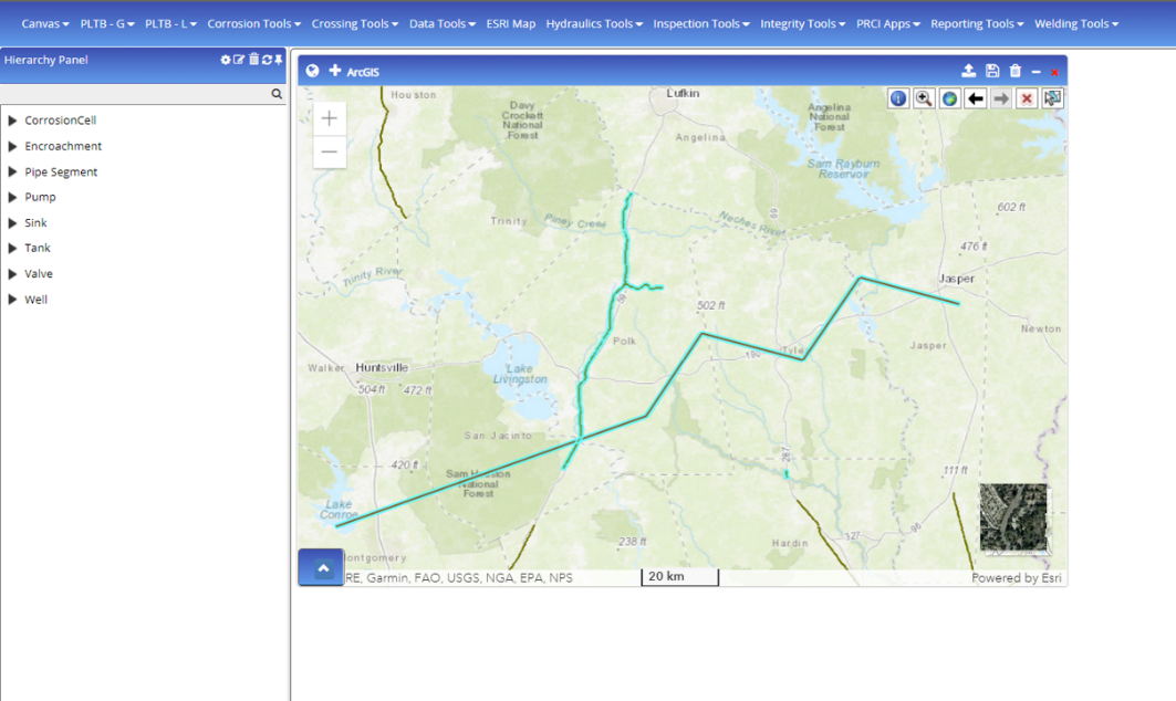
Engineering Analysis
-
GIS solutions have been integrated with engineering applications such as the hydraulic analysis of pipeline networks to enhance the graphical visualization of results for real-time operations surveillance and monitoring of abnormal conditions.
Example illustrating use of pressure profile to track movement of freezing front in a gathering network
Visualization
-
GIS maps require categories organized as layers which when selected are overlaid on the underlying geographical map (base layer) to create a complex map displaying the relevant information
Example overlaying of GIS layers